GoHunt and OnXMaps are leading platforms for hunters and outdoorsmen seeking mapping and hunt planning tools. GoHuntfocuses on Western hunting, while OnXMaps provides comprehensive land mapping across the US.
As outdoor activities continue to grow in popularity, the need for reliable digital tools to enhance the experience has become evident. GoHunt specializes in providing detailed draw odds, hunting unit data, and gear shop tailored for hunters primarily in the Western US, with a strong emphasis on big game hunting.
On the other hand, OnXMaps offers a broad spectrum of navigational features, including detailed property boundaries, public and private land identification, and versatile GPS functions, catering to hunters, hikers, and campers nationwide. Both platforms offer mobile apps to aid users while they are in the field, each with their strengths, depending on the user’s specific needs and geographic focus.

Credit: m.youtube.com
Introduction To Digital Mapping Tools
Digital mapping tools have transformed how we explore the great outdoors. From hunters to hikers, technology now offers detailed maps right at our fingertips. With applications like goHunt and onXmaps, navigation has never been more accurate or convenient.
The Rise Of Mapping Applications
High-tech maps are changing our adventures. Just a few years ago, we relied on paper maps and compasses. Today, digital maps show us the way with just a few taps on a screen. They tell us where we are and what lies ahead.
- Real-time GPS tracking
- Vast databases of trails and landmarks
- Customizable waypoints
Outdoor Excursions Enhanced By Technology
Smartphones and GPS devices bring a new level of security and fun to our trips. goHunt and onXmaps lead the pack with features designed for the wilderness enthusiast.
| Feature | goHunt | onXmaps |
|---|---|---|
| Land Ownership Data | Yes | Yes |
| Offline Maps | Yes | Yes |
| Custom Waypoints | Yes | Yes |
Key Features Of Gohunt
Welcome to the key features of goHUNT, your reliable navigator in the wild. Unlocking the digital outdoors has never been easier. Here, we delve into the exceptional elements that set goHUNT apart.
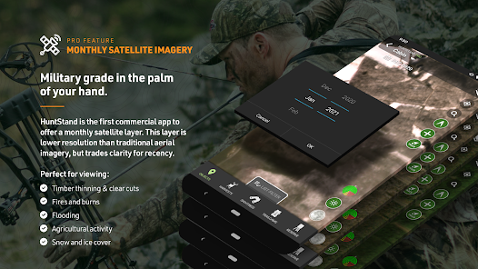
Topographic Detail And Map Layers
Understanding the terrain is crucial for successful hunting. goHUNT excels with its topographic detail:
- High-resolution maps show the land’s ups and downs.
- Shaded relief for easy-to-read contours.
- Layering feature lets you customize what you see.
- View public and private boundaries accurately.
Switch between satellite, hybrid, and topographic views effortlessly. Your excursion into the wild now has clarity like never before.
Hunting Zones And Wildlife Data Integration
With goHUNT, you tap into a wealth of wildlife data to plan your hunt:
- Get data on preferred animal habitats.
- See detailed hunting boundaries with ease.
- Access seasonal movement information of game.
- Integrate hunting zones with real-time GPS data.
Be ahead in the game by knowing where and when to hunt. goHUNT bridges the gap between a good hunter and a great one.
Key Features Of Onxmaps
OnXmaps is a cutting-edge tool that transforms the outdoor experience. This application boasts an array of impressive features. They enhance a user’s ability to navigate and utilize land data efficiently. Two key features that stand out are land identification and offline functionality.
Private And Public Land Identification
Understanding the boundaries between private and public terrain is crucial. OnXmaps excels in providing clear demarcations. Users can access detailed property lines and landowner information. This aids in respecting private spaces and exploring public lands responsibly.
- View landowner names on private lands
- Easily distinguish between types of public land
- Access possible access points for public lands
Offline Map Usage And Gps Functionality
Connectivity can be unreliable in the wilderness. With OnXmaps, download maps for offline use. Track your location using the built-in GPS, even without a signal. This ensures constant orientation and safety during your adventures.
- Save maps for areas of interest
- Use GPS to navigate without data connection
Keep your adventure on track with OnXmaps’ offline maps and GPS tools.
Comparing Usability And Interface
When it’s time to head outdoors, a trustworthy navigation app is essential. Gohunt and Onxmaps are leading the way. The right choice can make the journey easy and enjoyable. Let’s put them side by side. We’ll examine user-friendliness and how they perform on different devices.
User-Friendly Design Face-offUser-friendly Design Face-off
A great app feels simple to use. Both Gohunt and Onxmaps boast clean layouts. Still, there are differences.
- Gohunt shines with intuitive menus.
- Onxmaps counters with easy-to-understand icons.
Colors and text in both apps are clear. They help users quickly find features. Both cater to beginners and seasoned adventurers.
Mobile and Desktop ExperienceMobile And Desktop Experience
Gohunt and Onxmaps work on phones and computers. The experience should be seamless.
| Gohunt | Onxmaps | |
|---|---|---|
| Mobile | Fast and reliable | Offline maps available |
| Desktop | Full-screen maps | Detailed terrain info |
Gohunt is smooth on desktop, with a focus on planning. Onxmaps offers more data, which can be a boon for in-depth research. On phones, both apps keep you on track without a hitch.
Subscription Models And Pricing
Choosing the right hunting app matters. Gohunt and Onxmaps offer outdoor navigation tools. They use subscription models. These models impact your wallet. It’s key to understand costs and plans. This helps choose the best option for you. Let’s dive into Subscription Models and Pricing for Gohunt and Onxmaps.
Cost Comparison
Different prices mean different choices. Gohunt shows one price. Onxmaps shows another. Each service charges users yearly. They help with map access and hunting data. Look at the costs carefully.
| Service | Annual Cost |
|---|---|
| Gohunt | $100 |
| Onxmaps | $30 |
Flexible Plans And Free Trials
Both apps have trial periods. They let users test before buying. Gohunt offers a 7-day trial. Onxmaps offers a free version. Full features come with their paid plans. Check these plans for the best fit.
- Gohunt: 7-day trial, then full access with subscription.
- Onxmaps: Limited free version, upgrade to unlock everything.
Field Performance: Reliability Under Test
When adventurers venture into the wild, they rely on their tools. Mapping apps like Gohunt and Onxmaps become critical survival gear. But which one stands the test of real-life use? Let’s delve into their field performance.
Real-world Application Scenarios
Both apps offer features for outdoor enthusiasts. Their true potential shows on the trail.
- Gohunt is favored by hunters for its detailed private land boundaries.
- Onxmaps excels with offroad trail maps popular among hikers.
Users report that Onxmaps provides crucial data in deep woods. Gohunt users value exclusive animal data points during hunting season.
Battery Life And Resource Consumption
The best app should not drain your phone’s battery. Here’s how each stacks up.
| App | Battery Drain |
|---|---|
| Gohunt | Minimal |
| Onxmaps | Moderate |
Onxmaps’ detailed maps may use more power. Gohunt offers longer in-field use with its optimized resource consumption.
Community And Support
The heart of any service-oriented platform is its community and support. For outdoor enthusiasts choosing between GoHunt and onXmaps, the quality of customer service and the richness of their learning resources can be a deciding factor. Each platform hosts a supportive community, offering various tools to ensure you venture out with confidence.
Customer Service Experiences
Rock-solid customer service can turn a good app into a great one. GoHunt prides itself on personal attention, with users reporting quick and helpful responses. On the other side, onXmaps shines with comprehensive FAQs and troubleshooting guides, minimizing any potential downtime on the trail.
Educational Resources And User Communities
Knowledge is power when exploring the great outdoors. Both GoHunt and onXmaps provide users with valuable information. However, they approach education differently:
- GoHunt emphasizes strategy with articles and videos on tracking and planning your hunt.
- onXmaps excels with detailed map layers and property boundaries to keep you informed and legal.
Their user communities are also vibrant, with forums and social media groups where enthusiasts share experiences, tips, and camaraderie.
Credit: play.google.com
Final Verdict: Choosing The Right Tool
Hunters and outdoors enthusiasts often find themselves at a crossroads when it comes to selecting the best mapping software. With the market offering several robust options, Gohunt and Onxmaps emerge as top contenders. This section dives into the pivotal aspects of each service to help you make a well-informed decision that caters to your unique needs.
Your choice between Gohunt and Onxmaps should hinge on specific features that align with your personal hunting experiences.
- Do you require detailed land ownership information? Onxmaps excels here.
- Are trophy hunting tools a priority? Gohunt may suit you better.
- Looking for intuitive user interface? Test both to feel their ease of use.
- Consider the regions you frequent and the species you track when choosing.
| User Type | Gohunt | Onxmaps |
|---|---|---|
| New Hunters | Guided tutorials available | User-friendly interface |
| Veteran Hunters | Advanced tools for planning | Comprehensive land data |
| Hikers & Campers | Essential info for trails | Detailed land terrain maps |
| Conservationists | Species distribution insights | Ecosystem mapping features |
In essence, Onxmaps offers a wealth of navigational aids and proprietary data layers ideal for those seeking clarity on land boundaries, while Gohunt places more emphasis on the hunting aspects, with gear lists and species research. Your regular activities and priorities will direct you towards the mapping solution that can best enhance your outdoor adventures.
Credit: m.youtube.com
Frequently Asked Questions On Gohunt Vs Onxmaps
What Are The Core Features Of Gohunt?
Gohunt primarily offers in-depth research on hunting units, season strategies, and gear. It features draw odds, tag application assistance, and expert articles. The platform is tailored for avid hunters planning their next hunt.
How Does Onxmaps Enhance Outdoor Navigation?
Onxmaps provides detailed land ownership maps, GPS tracking, and offline usage capabilities. It’s ideal for outdoor enthusiasts who need real-time data to navigate unfamiliar territory safely.
Can Gohunt And Onxmaps Integrate Together?
Currently, Gohunt and Onxmaps operate as separate platforms and do not offer direct integration. Users utilize each app’s unique features to complement their outdoor activities.
What Sets Gohunt Apart From Onxmaps?
Gohunt sets itself apart with a focus on hunting preparation and research. It offers resources like species-specific insights and expert advice, setting it apart from the general navigation focus of Onxmaps.
Conclusion
Deciding between Gohunt and Onxmaps gets easier once you prioritize. Both tools have standout strengths for hunting enthusiasts. Gohunt excels with in-depth research features, while Onxmaps leads in real-time navigation. Your preference depends on whether you favor pre-hunt planning or dynamic in-field guidance.
Whichever you choose, your adventures are set to become more informed and thrilling. Happy hunting!